On this page
The setting of the city
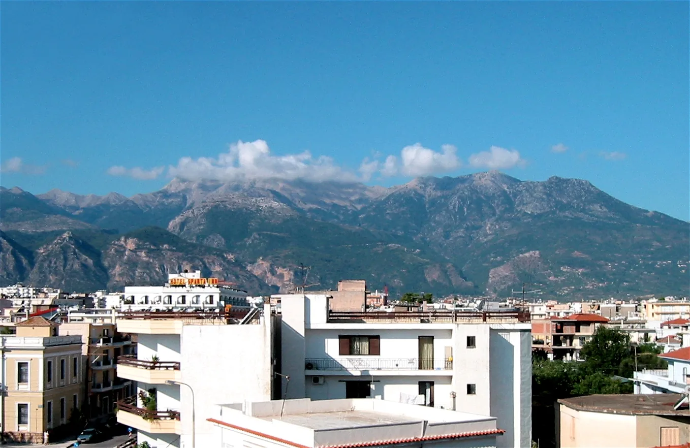
Sparta developed close to the Eurotas, the principal river of Laconia. The valley provided a setting for settlement and agriculture, while Taygetus rose prominently to the west. Parnon formed a further mountainous boundary to the east. The relationship between cultivable lowlands, river crossings, and upland routes helped shape everyday movement. It also gave the city a landscape that ancient writers and modern visitors found memorable.
Geography offered opportunities rather than a predetermined political system. Other communities farmed river valleys or lived beside mountains without developing Sparta's institutions. The surroundings mattered because people organized land, labor, travel, and worship within them. Explaining Spartan society entirely through a supposedly harsh environment confuses a physical setting with the human decisions and unequal relationships that made that setting productive.[3][1]
Water, cultivation, and work
The river and its tributaries connected different parts of the interior and supplied an important focus for settlement. Fertile land along the valley supported agricultural activity, but ancient farming remained dependent on seasonal conditions and the labor needed to work particular soils. Grain, vines, and olives required different tasks and timetables. Livestock connected cultivated land with less intensively used slopes and uplands.
The citizen community's association with military service did not remove farming from Spartan history. It transferred much of the burden to other people, particularly helots. The landscape visible from the city was consequently also a landscape of obligations and extraction. An attractive view of fields cannot reveal who controlled their produce, who performed the work, or how insecure a cultivator's position might be. Those questions require legal, social, and political evidence alongside topography.[3][1]
Mountains as boundaries and connections
Taygetus separated the Spartan plain from much of Messenia and complicated movement between them. Mountain routes could affect the timing and direction of travel, campaigning, and communication. Yet a mountain range is rarely an absolute wall. Passes, paths, and accumulated local knowledge enabled people to cross it. Sparta's long involvement west of Taygetus is itself a reminder that physical separation did not prevent political domination.
Ancient descriptions give mountains religious and legendary associations as well as practical significance. A landscape could be inhabited by stories, gods, and remembered events. Modern readers should distinguish these associations from evidence for specific historical practices. In particular, the familiar image of infants routinely being thrown from Taygetus compresses a much-debated late literary tradition into an apparently certain geographical fact. Neither a dramatic mountain nor the repetition of a story is sufficient proof of that practice.
Taygetus also appears in accounts of routes between Laconia and Messenia. A mountain barrier could divide zones of cultivation while remaining crossed by travelers, armies, and people seeking escape.[1][3]
Reading an ancient landscape today
A modern map supplies useful orientation, but it is not a photograph of antiquity. River channels, vegetation, settlement patterns, and roads can change. Even where the broad mountain forms remain recognizable, the ways people used them differ. Ancient coastal and river environments also require caution when locating battles or settlements. A map marker should identify a representative place, with uncertainty made explicit when the evidence does not justify precision.
Archaeological survey offers a way to move beyond the few sites emphasized by literary authors. Surface finds and recorded settlements can suggest patterns of occupation and land use, though they are affected by erosion, visibility, and the limits of collection. The Eurotas and Taygetus are therefore best treated as a framework for historical questions. They help explain routes and resources, but the history emerges through the changing relationships among inhabitants, their work, the places they valued, and the authorities that claimed control over them.[2][1]
FOLLOW THE EVIDENCE
References & further reading
- Ancient textPausanias, Description of Greece, Book 3 ↗
The second-century CE travel account of Laconia. Its monuments and local traditions belong to the author's time and require comparison with earlier evidence.
- ArchaeologyThe Laconia Survey Project: Overview ↗
Archaeology Data Service archive of the regional survey. Rural evidence complements descriptions centered on the citizen elite.
- Modern scholarshipDictionary of Greek and Roman Geography: Laconia ↗
William Smith's 1854 reference, public domain. Useful for ancient geographic descriptions; its historical interpretations should not replace modern research.